Flood Protection Information

If your property was impacted by the Almeda Fire and is within the Special Flood Hazard Zone (SFHA), please visit the city's Flood After the Fire webpage for valuable property protection resources.
Information on this page is provided solely for informational purposes only. Please contact your insurance agent for more information specific to your policy or property.
The information on this webpage is for properties located within or adjacent to the 100-year floodplain boundary.
Common Terms
A Flood Insurance Rate Map (FIRM), Flood Boundary and Floodway Map (FBFM), and Flood Hazard Boundary Map (FHBM) are all flood maps that have been produced by FEMA. The FIRM is the most common map and most communities have this type of map. At a minimum, flood maps show flood risk zones and their boundaries, and may also show floodways and Base Flood Elevations (BFEs). The FBFM is no longer produced; current FIRMs include all of this information. The FHBM is an older version of a flood map and is based on approximate data.
The FEMA Flood Insurance Study (FIS) and Flood Insurance Rate Maps (FIRMs) were adopted in 1981 and updated in 2011. The FIS and FIRMs are used by federally-regulated lending institutions and determining who must purchase flood insurance and the cost of that insurance, should it be required. In addition, the maps are used by City and County officials for floodplain management and permitting purposes.
To determine whether your property is in the Federal Emergency Management Agency (FEMA) floodplain, please visit their Map Service Center.
Streamgage Information
Bureau of Reclamation (USBR) Streamgage information.
The USBR operates a network of automated hydrologic and meteorologic monitoring stations located throughout the Pacific Northwest. This network and its associated communications and computer systems are collectively called Hydromet. Remote data collection platforms transmit water and environmental data via radio and satellite to provide cost-effective, near-real-time water management capability. Other information, as available, is integrated with Hydromet data to provide timely water supply status for river and reservoir operations. Hydromet data in the Region
US Geological Survey (USGS) Streamgage information.
USGS provides near-real-time streamgage information for two locations along Bear Creek, including Central Medford and North Ashland. The nearby upstream North Ashland streamgage has data been recording since 1990, and is located 0.1mi downstream from Ashland Creek at mile 21.0 (Latitude 42°12'58", Longitude 122°43'16" NAD27). Elevation of the gage is 1,686.64ft above sea level (NGVD29). EXTREMES FOR PERIOD OF RECORD - Maximum discharge, 12,000 ft³/s Jan. 1, 1997, gage height 11.00 ft; minimum discharge, 0.33 ft³/s Oct. 18, 1990. Interactive USGS National Water Information System Mapper. You may search by address, location, or streamgage number.
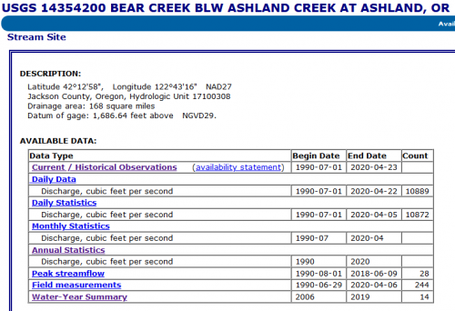
Click the image to get near-real-time data for the nearby N. Ashland Streamgage at Bear Creek (Streamgage #14354200)
Elevation Certificates
The City of Talent collects, maintains “finished construction” Elevation Certificates for all new or substantial improved structures built in the SFHA. These documents are available at no cost, upon request. To see if your property has an Elevation Certificate on file, you may use the interactive Environment WebMap, or contact the Community Development Department.
Flood Insurance Resources
- Flood Insurance Study
- What is a 100-Year Flood Plain
- Know Your Risks
- After the Flood
- Filing a Flood Insurance Claim
- Floodsmart Resources for Property Owners
- Flood History and Causes
- Flood Insurance Questions for Real Estate Professional
- What You Need to Know about Flood Insurance
- Why You Need Flood Insurance
- Community Rating System Fact Sheet
Index Map
- Map
2011 Adopted FIRM Panels
- 41029C1993
- 41029C1994
- 41029C2181
- 41029C2182
National Flood Insurance Program Information: FloodSmart.gov